
Right-of-Way Maps
Sanborn Maps
| 1867 Sanborn Key | ||||||
| Barnesville | Barton | Bellaire | Bridgeport | Martins Ferry | Powhatan Point | St. Clairsville |
| 1885 | 1917 | 1884 | 1886 | 1885 | 1925 | 1887 |
| 1893 | 1924 | 1890 | 1893 | 1890 | 1893 | |
| 1899 | 1895 | 1897 | 1895 | 1899 | ||
| 1908 | 1900 | 1903 | 1900 | 1911 | ||
| 1915 | 1908 | 1910 | 1908 | 1924 | ||
| 1922 | 1915 | 1917 | 1915 | 1929 | ||
| 1929 | 1924 | 1927 | 1924 | 1946 | ||
Belmont County 1888 Atlas
Surveys of the Townships embraced in Belmont County, O. 1870
1894 Transcript of Government Field Notes
Railroad Valuation Maps
BALTIMORE AND OHIO: BELLAIRE, OHIO TO BARNESVILLE, OHIOV122.2: 1V122.2: 1-A V122.2: 1-B V125.1: 1 V125.1: 2 V125.1: 3 V125.1: 4 V125.1: 5 V125.1: 6 V125.1: 7 V125.1: 8 V125.1: 9 V125.1: 10 V125.1: 11 V125.1: 12 V125.1: 13 V125.1: 14-S V125.1: 14-A V125.1: 15 V125.1: 16 |
|
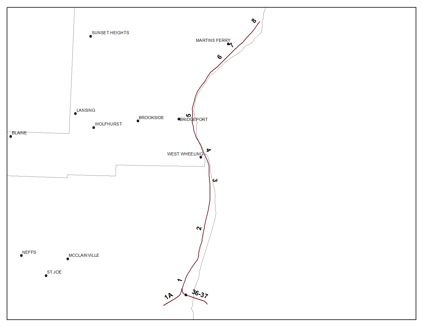
BALTIMORE AND OHIO: BENWOOD, WEST VIRGINIA TO MARTINS FERRY, OHIOV45.2: S-36V45.2: S-36/37 V45.2: 35 V45.2: 36 V45.2: 36-A V122.2: 1 V122.2: 1-A V122.2: 1-B V122.2: 2 V122.2: 3 V122.2: 4 V122.2: 5 V122.2: 6 V122.2: 7 V122.2: 8 |
|
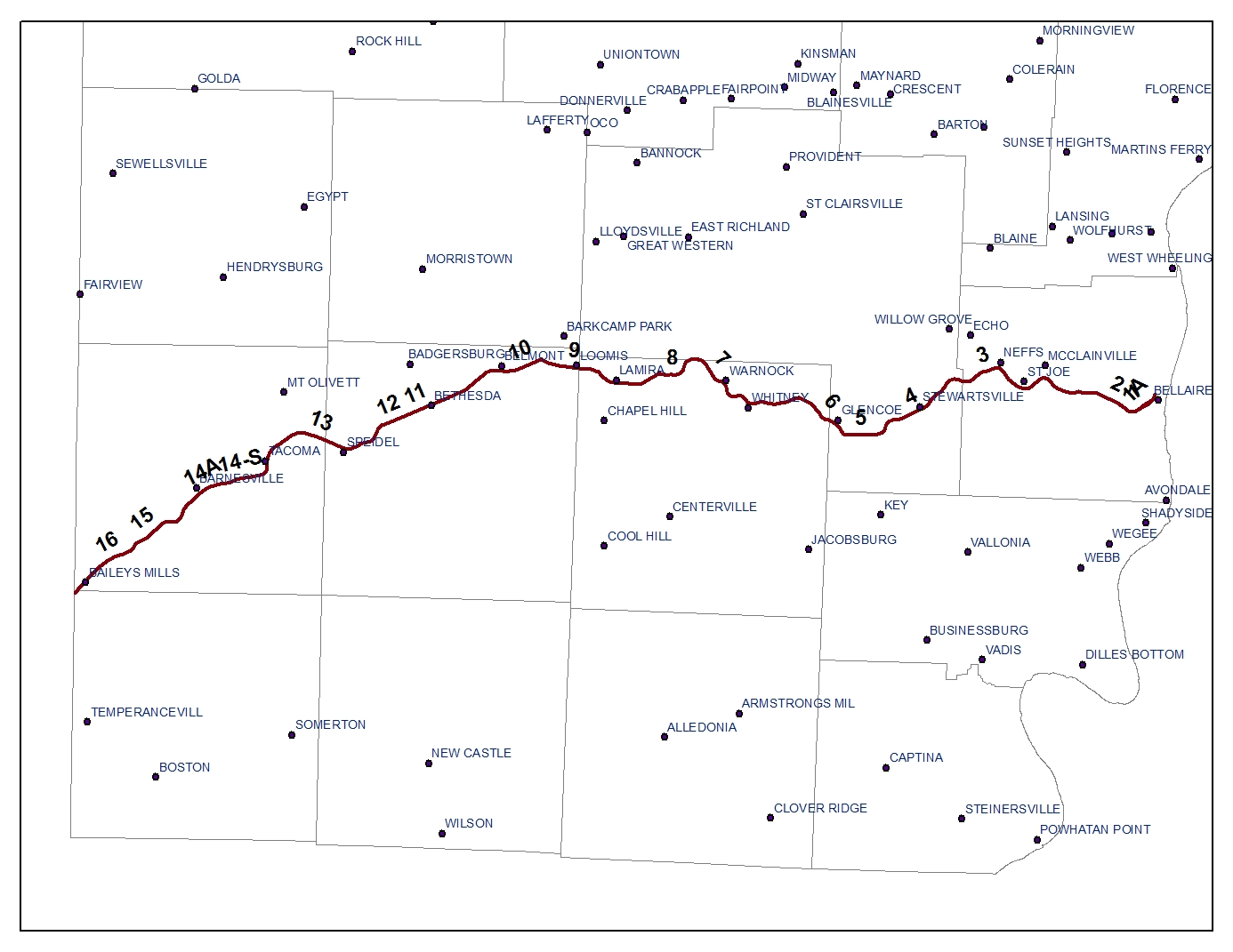
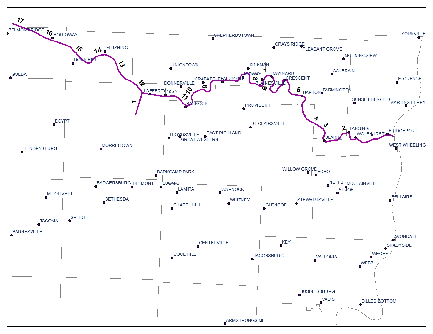
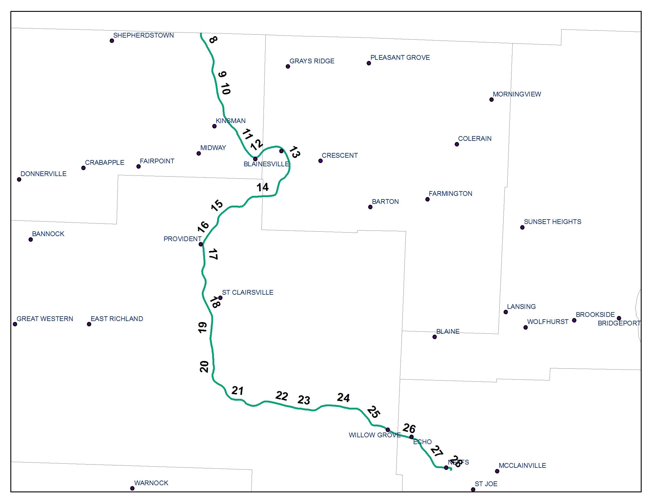
BALTIMORE AND OHIO: BRIDGEPORT, OHIO TO HOLLOWAY, OHIOV122.1: S-1BV122.1: SL-1A V122.1: ST-1A V122.1: 1 V122.1: 1-A V122.1: 2 V122.1: 2-A V122.1: 3 V122.1: 4 V122.1: 5 V122.1: 6 V122.1: 7 V122.1: 8 V122.1: 9 V122.1: 10 V122.1: 10-A V122.1: 11 V122.1: 12 V122.1: 13 V122.1: 14 V122.1: 15 V122.1: 15-A V122.1: 15-S V122.1: 16 V122.1: 16-S V122.1: 17 V122.3: 1 |
|
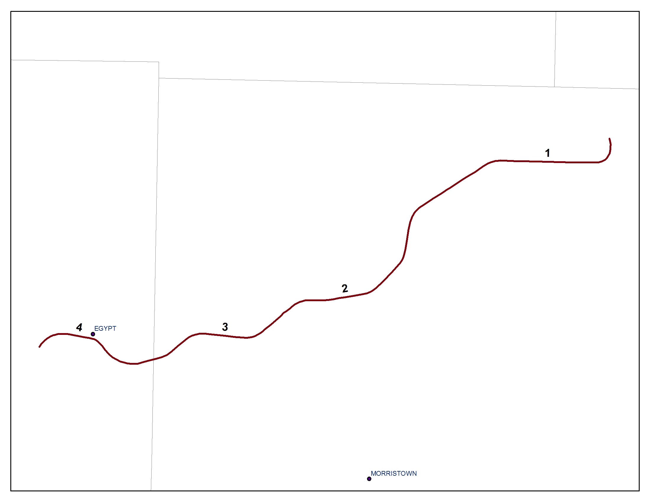
BALTIMORE AND OHIO: LAFFERTY, OHIO TO HENDRYSBURG, OHIOV122.11: 1V122.11: 2 V122.11: 3 V122.11: 4 |
|
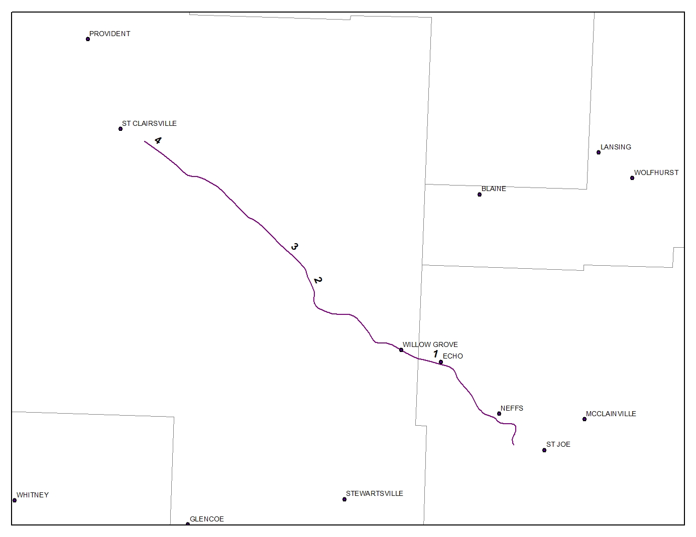
BALTIMORE AND OHIO: ST CLAIRSVILLE, OHIO TO NEFFS, OHIOV125.2: 1V125.2: 2 V125.2: 3 V125.2: 4 |
|
PENNSYLVANIA COMPANY: OHIO RIVER AND WESTERN (BELLAIRE, OHIO TO KELSEY, OHIO)
BELLAIRE, OHIO TO WEBB, OHIOWEBB, OHIO TO KELSEY, OHIO
PENNSYLVANIA COMPANY: WHEELING TERMINAL RAILWAY (MARTINS FERRY, OHIO)
V.1: 1V.1: 2
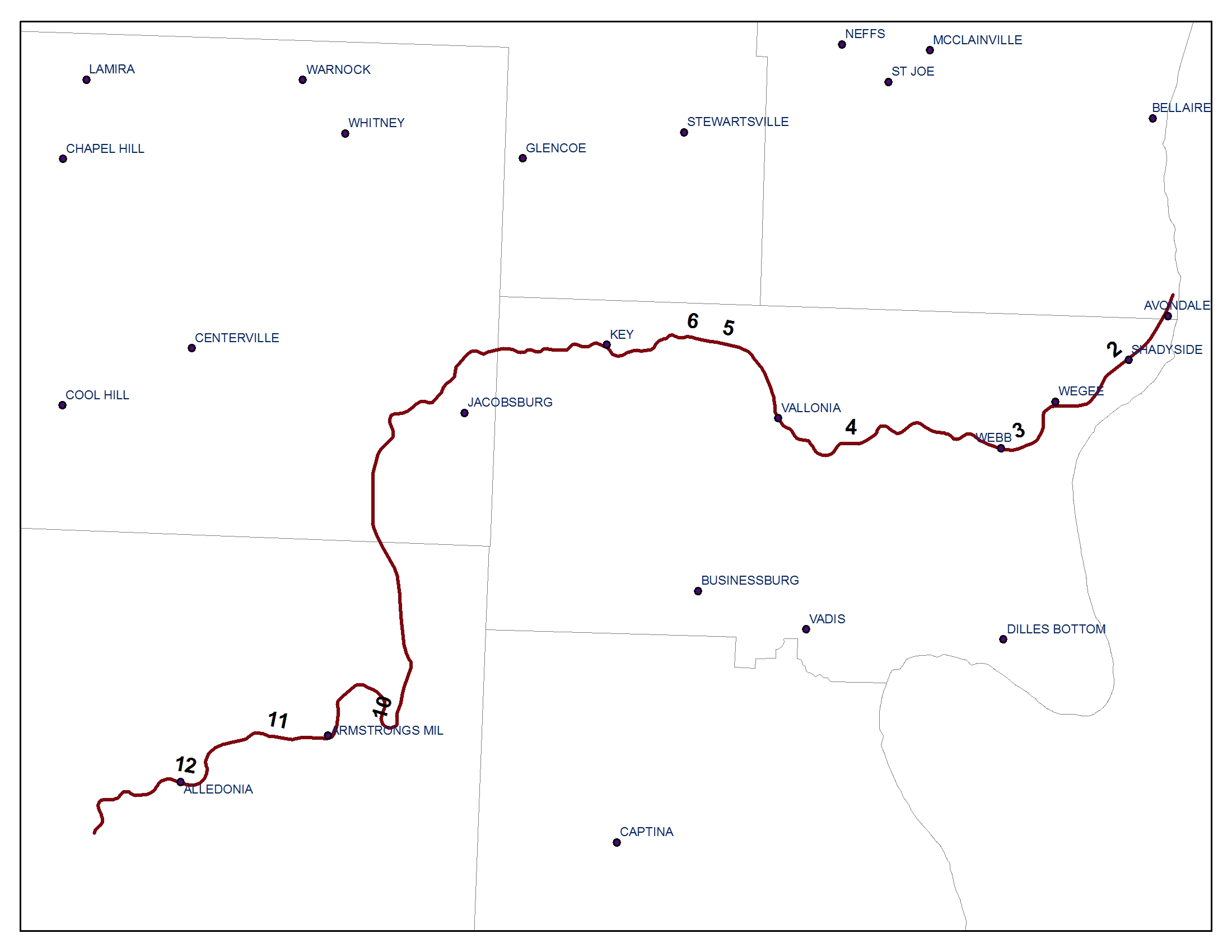
PENNSYLVANIA COMPANY: OHIO RIVER AND WESTERN (SHADYSIDE, OHIO TO ALLEDONIA, OHIO)V.1A: 2V.1A: 3 V.1: 4 V.1: 5 V.1: 6 V.1: 10 V.1: 11 V.1: 12 |
|
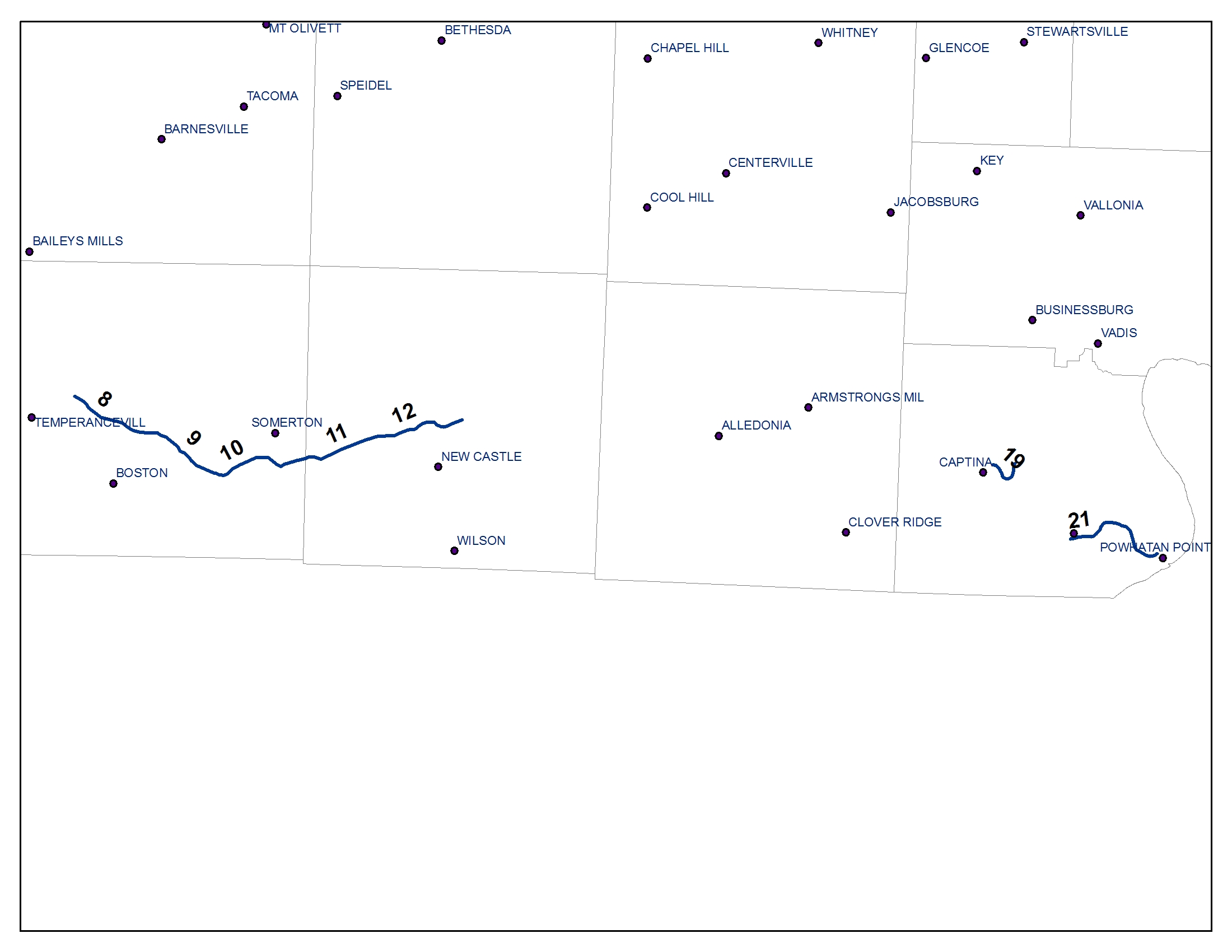
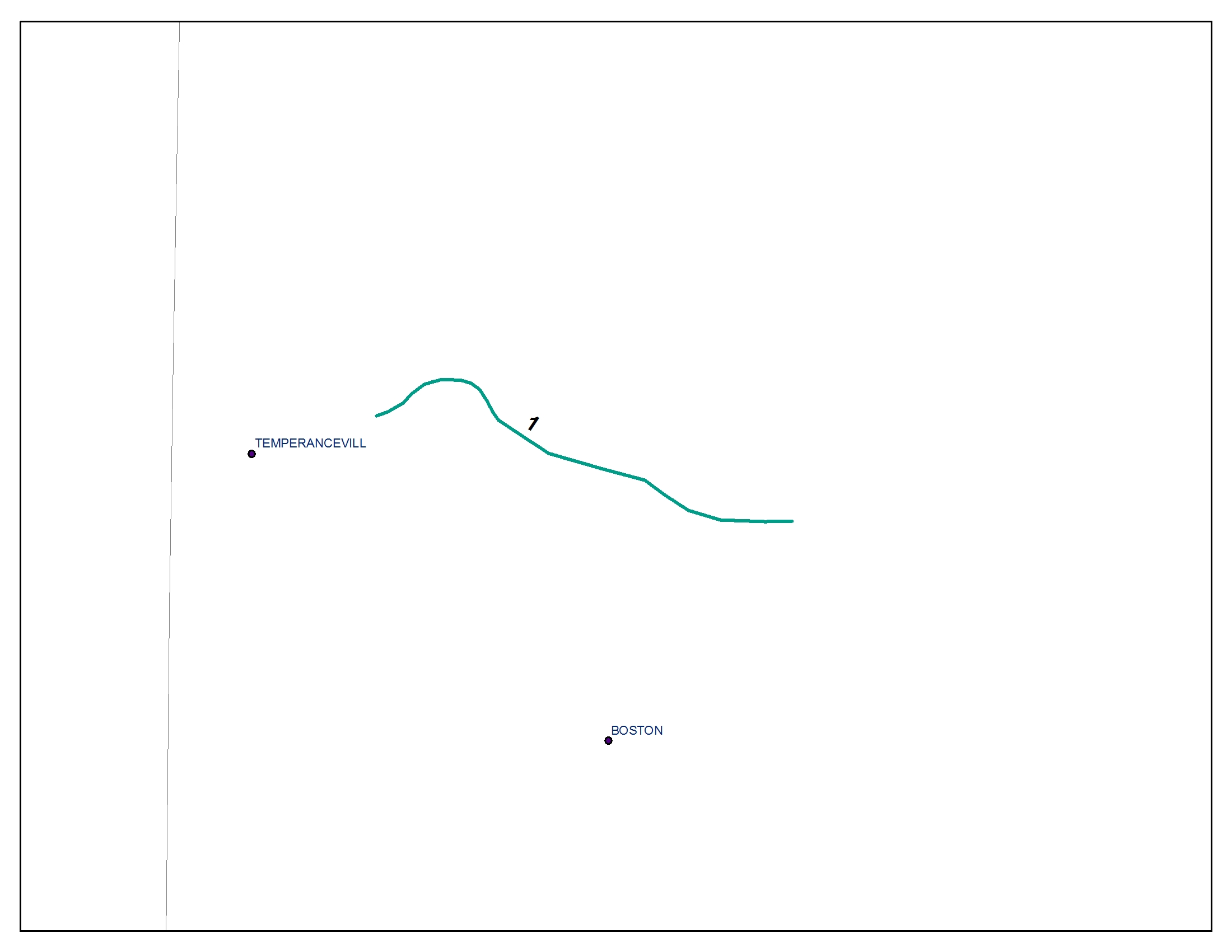
PENNSYLVANIA COMPANY: OHIO RIVER AND WESTERN (TEMPERANCEVILLE, OHIO TO NEW CASTLE, OHIO)V.1B: 8V.1B: 9 V.1B: 10 V.1B: 11 V.1B: 12 V.1B: 19 V.1B: 21 |
|
PENNSYLVANIA COMPANY (PITTSBURGH, OHIO VALLEY, AND CINCINNATI): POWHATAN POINT, OHIO TO WAYNE TOWNSHIP, OHIO
V12: 15.1V12: 15.2
V12: 15.3
V12: 15.4
V12: 15.5
V12: 15.6
V12: 15.7
V12: 15.8
V12: 15.9
V12: 15.10
V12: 15.11
V12: 15.12
V12: 15.121
V12: 15.122
V12: 15.123
V12: 15.124
V12: 15.13
V12: 15.14
V12: 15.15
V12: 15.16
V12: 15.17
V12: 15.18
V12: 15.19
V12: 15.20
PENNSYLVANIA COMPANY (PITTSBURGH, OHIO VALLEY, AND CINCINNATI): SHADYSIDE, OHIO TO POWHATAN POINT, OHIO
V12: 4V12: 5
V12: 6
V12: 7
V12: 8
V12: 9
V12: 10
V12: 11
V12: 12
V12: 13
V12: 14
V12: 15
V12: 16
PENNSYLVANIA COMPANY (PENNDEL): PROPOSED EXTENSION OF CAPTINA BRANCH, OHIO FROM M.P. 7 TO M.P. 18
CRABAPPLE BRIDGEPLAN SHEET INDEX
SHEET 5
SHEET 5-A
SHEET 6
SHEET 7
SHEET 8
SHEET 9 & 10
PENNSYLVANIA COMPANY: TOLEDO, COLUMBUS, AND OHIO RIVERV.6B: 1 (RIGHT OF WAY MAP AND TRANSFER INDEX (2 PAGES)) |
|
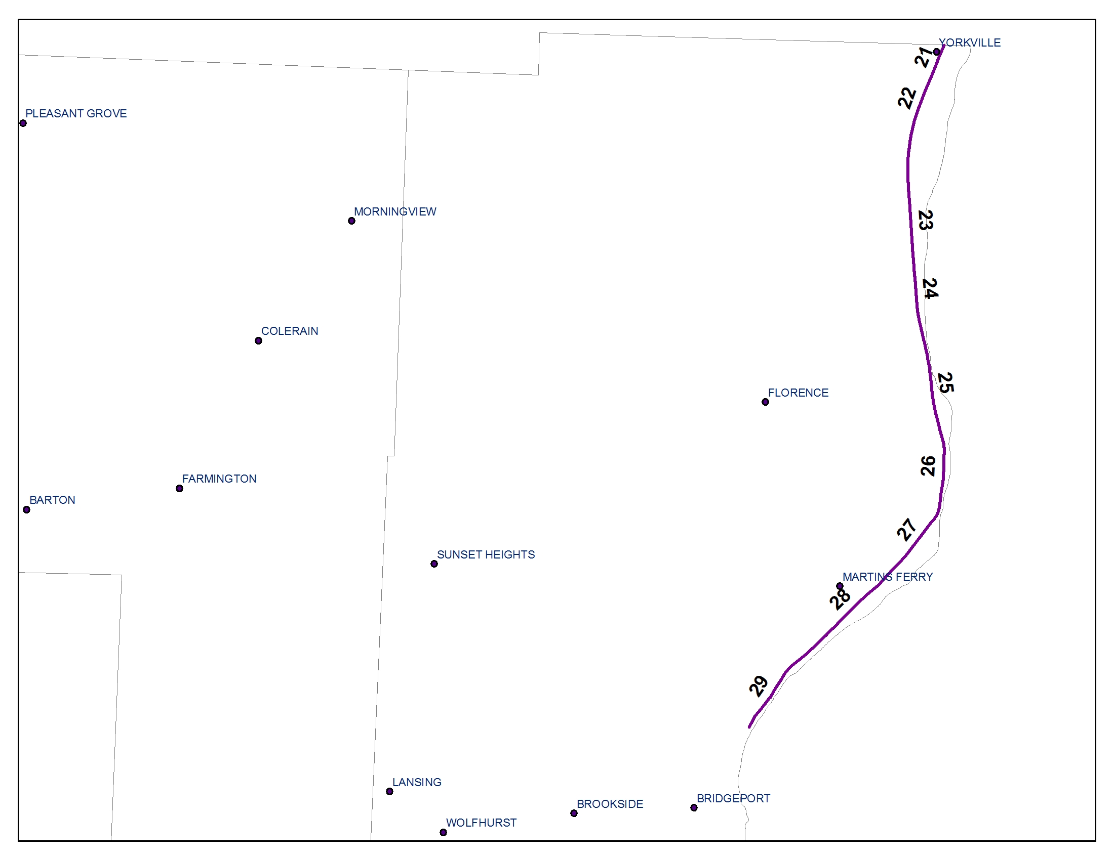
WHEELING AND LAKE ERIE: YORKVILLE, OHIO TO BRIDGEPORT, OHIOBOOK 8: SHEET 16-FBOOK 8: SHEET 21 BOOK 8: SHEET 22 BOOK 8: SHEET 23 BOOK 8: SHEET 24 BOOK 8: SHEET 25 BOOK 8: SHEET 26 BOOK 8: SHEET 26-A BOOK 8: SHEET 27 BOOK 8: SHEET 28 BOOK 8: SHEET 28-A BOOK 8: SHEET 29 |
|